Blaj (Municipiul Blaj)
 |
The landmark of the city is the fact that it was the principal religious and cultural center of the Romanian Greek-Catholic Church in Transylvania.
Blaj is first mentioned in 1271 as Villa Herbordi, after the deed of a Count Herbod. In 1313, the domain passed to Herbod's son Blasius Cserei and the town was mentioned as Blasii. Started as a hamlet for the twenty families of servants of the noble's court, it was awarded town status on May 19, 1737.
Blaj is the principal religious and cultural center of Greek Catholics in Transylvania. At 27 October 1687 begins the history of the Romanian Church United with Rome, Greek-Catholic, history directly connected to the history of the town Blaj. It all started at the end of the treaty through which Transylvania was entering under the protection of Austria, renouncing the protection of the Turkish Empire.
The first public school in Romanian was established in Blaj in 1754. Blaj was the first place to have Romanian written with Latin alphabet instead of Cyrillic in which it had traditionally been written. Blaj was also a center for the Romanian Age of Enlightenment, being the founding site of the Transylvanian School that promoted the Roman cultural heritage of the Romanians. Thus Blaj gained the nickname "The Little Rome", as Romania's national poet Mihai Eminescu called it.
In 1848, Câmpia Libertății in Blaj was where over 40,000 Romanians met to protest Transylvania becoming a part of Hungary, holding that the lands would be stolen from them.
Map - Blaj (Municipiul Blaj)
Map
Country - Romania
 |
 |
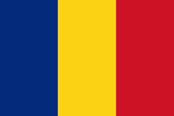
| Flag of Romania | |
Europe's second-longest river, the Danube, rises in Germany's Black Forest and flows southeasterly for 2857 km, before emptying into Romania's Danube Delta. The Carpathian Mountains cross Romania from the north to the southwest and include Moldoveanu Peak, at an altitude of 2544 m.
Currency / Language
| ISO | Currency | Symbol | Significant figures |
|---|---|---|---|
| RON | Romanian leu | lei | 2 |
| ISO | Language |
|---|---|
| HU | Hungarian language |
| RO | Romanian language |


